Have one like this?
Upload a photo for a free check of what yours may be worth.
Lot description
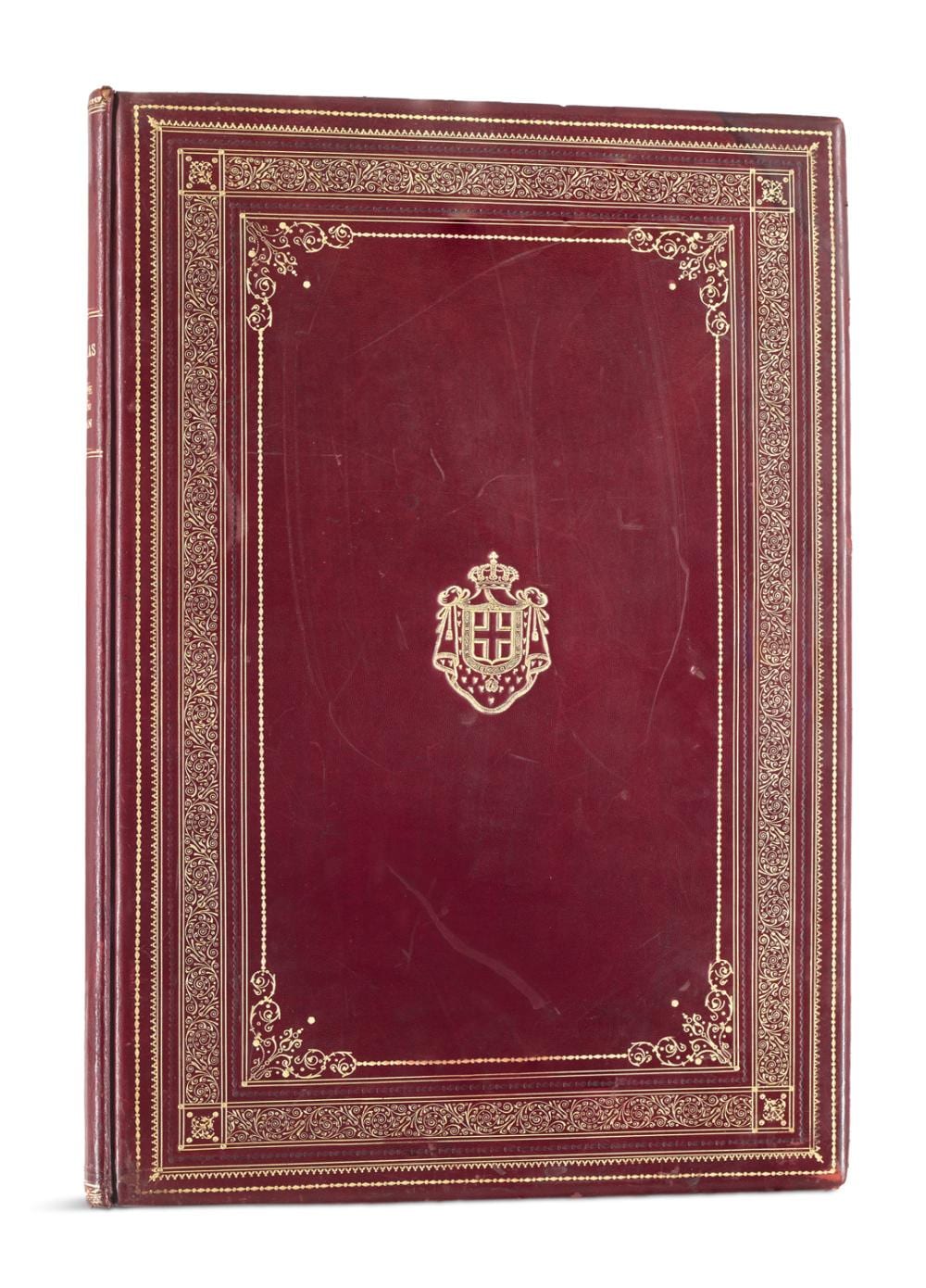
Wappeneinband Khanzadian, Z(adig) Atlas de Géographie Économique de Syrie et du Liban. Mit gestoch. u. kol. Titelblatt und 67 Karten (hiervon 55 in Farbe u. tls. mehrfach gefaltet). Paris, Bertalot, 1926. 2 Bll., 87 S., Tafelteil. Gr. Fol. Prachtvoller roter Maroquin auf dem Vorderdeckel mit goldgepr. Wappensupralibros des Königreichs Italien, mit reicher Blind- u. Goldprägung, goldgepr. RTitel und Vorsätzen aus roter Moiré-Seide signiert A. Antinori, Roma. (berieben und bestoßen, die Ecken/Kanten und der VDeckel mit Beschabungen, partiell mit leichten Kratzspuren, im unteren Rücken etw. brüchig und mit kl. Fehlstelle im Bezug, oben mit Feuchtigkeitsfleck). BnF cb35499556s. - Seltenes Exemplar im Wappeneinband, für uns in dieser Form derzeit nicht im internationalen Handel nachweisbar. - Zadig Khanzadian, gebürtiger Armenier, war ein bekannter Kartograph des frühen 20. Jahrhunderts. - Mit 18 Tafeln mit Reproduktionen alter Karten, 10 Tafeln mit zeitgenössischen geopolitischen und wirtschaftlichen Karten, gestochen von Kanzadian und A. Hausermann, mit historischen Karten von Syrien, Libanon, Zypern, Rhodos, Palästina und dem Heiligen Land, alle Karten mit Beschriftungen. - Papierbedingt zart gebräunt, partiell etw. stockfleckig. Insgesamt wohlerhalten. Coat of arms binding. - the front cover with gold embossed supralibros of the coat of arms of the Kingdom of Italy, with rich blind and gold embossing, gilt title to spine and endpapers in red moiré silk signed A. Antinori, Roma (rubbed and bumped, the corners/edges and the front cover with scuffing, partially with slight scratches, the lower spine somewhat brittle and with a small defect in the cover, on the top with moisture stain). - Rare copy in armorial binding, currently not verifiable for us in this form in international trade. - Zadig Khanzadian, born in Armenia, was a well-known cartographer of the early 20th century. - With 18 plates with reproductions of old maps, 10 plates with contemporary geopolitical and economic maps, engraved by Kanzadian and A. Hausermann, with historical maps of Syria, Lebanon, Cyprus, Rhodes, Palestine and the Holy Land, all maps with captions. - Paper slightly browned, partly somewhat foxed. Overall well preserved. Dieses Los ist regelbesteuert. Auf den Zuschlagspreis fallen 24,95% Aufgeld sowie auf den Rechnungsendbetrag 7% (Bücher, Kunst) bzw. 19% Mehrwertsteuer (Manuskripte, Siebdrucke, Offsetdrucke Photographien) in der Europäischen Union an. This work is subject to the regular margin scheme. There is a 24.95% buyer's premium on the hammer price and 7% (Books and Art) or 19% VAT (Manuscripts, Screenprints, Offsetprints and Photographs) on the final invoice amount in the European Union.